The train back to Harpers Ferry was running 1h20m late, which allowed Sheila and me to have breakfast at a diner next to the motel. I didn’t have to wait long at the platform and there were no technical issues to slow the train down. Still it was a five hour trip, and after following our progress on Google Maps I now know one reason. It seems that rail lines were built along rivers, perhaps because you could ship ties and rails and spikes by boat, perhaps because riverbanks have good geology or slope or something. But our train followed rivers faithfully all morning, and rivers meander all over the place. Ten miles as the crow flies can easily become 30 miles as the river wanders, and that’s what these rail lines do.
I got a lot of good looks at several rivers, and they were all running close to flood levels from all the rain. A few trees were flooded, the waters were muddy greenish brown, and the current was very fast. It made for a more interesting ride than the night ride west because at least there was something to look at.
I spent about an hour in Harpers Ferry but all I really did was walk to the hostel, switch to my new shoes which had been delivered there while I was away, walk back downtown, and buy a roll of tape from the outfitters so that I could tape my leg if my tendinitis comes back. At the hostel I met someone I’d seen earlier who had just finished a section hike southbound, and he told me to aim for the first shelter north because it was very nice.
The trail north from Harpers Ferry (in Maryland now) follows an old rail bed (which is part of a network of bike trails that Checklist told me goes all the way to DC), and at the same time runs beside the ruins of the old B&O canal. Another train track, still in use, runs above the canal. At any given point the canal is either a 20 to 40 yard section of deep water covered in a slimy bright green, perhaps duckweed, or has filled in over time and become forest. The Potomac river, also creeping up its banks, runs on the other side of the rail bed. Walking on the trail is a bit dull in that section but at least you don’t have to watch every step. You just glance ahead every so often so you can avoid puddles and mud.
After about four miles the trail climbed a slope, leaving cars, trains and rivers behind. The climb took about an hour. Then the trail straightened and leveled out making walking faster. This is how I remember most of the Maryland AT from my section hike last year… flat and level and fast.
I got to Ed Garvey shelter around 5. Young Blood, a college freshman or sophomore who was doing a SOBO thru hike he’d started last year, was already at the shelter. He was very friendly and since he had hiked everything I’m going to hike, he had lots of helpful advice. Eleanor, who just started a flip flop today, just graduated from a Masters in English Literature and hopes to become a high school English teacher. She’s from Cincinnati. Her flip flop means Harpers Ferry to Katahdin followed by Harpers Ferry to Springer Mountain. Hickory arrived later. He’s retired. I didn’t get a chance to learn much about him but he is NOBO so hopefully we can chat at a future shelter.
Since it felt kind of warm and I didn’t want to have to risk the shelter, where I would have to choose between being too hot in my sleeping bag or eaten by mosquitoes because I was lying on top of it. I put up my tent, which was still damp from my last night on trail. But the four of us ate and chatted for quite a while. At 7 I excused myself so I could journal and get to bed early. I only walked about 9 miles today (some in town so it isn’t reflected in the numbers below) but I slept poorly in the hotel last night and am getting over a cold I presumably caught from the stress of the train ride to Connellsville and the 45 minute walk at 4am through the rain. I hope tomorrow I can get much better mileage but the weather for the next few days still looks pretty wet.
Mile 1027 to mile 1033.5 = 6.5 miles
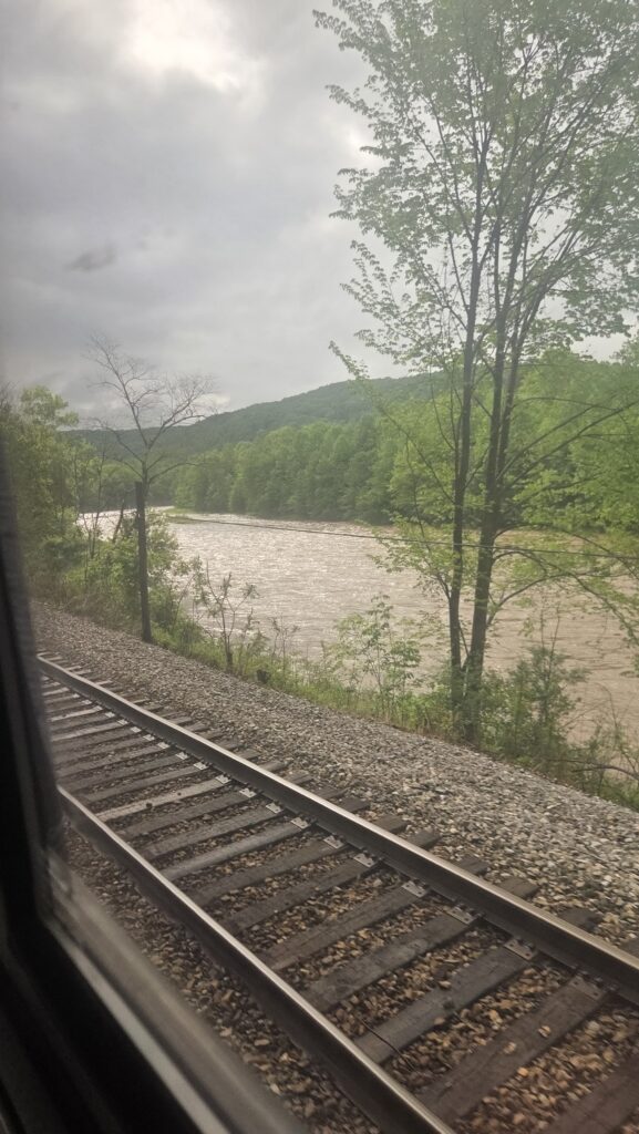
High waters seen from the train
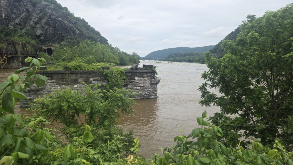
The Potomac seen from the pedestrian bridge that crosses it at Harpers Ferry

Notice how straight and flat the Maryland trail is