I’ve been setting my alarm about 3 minutes earlier each day so that I continue to wake up as close to dawn as possible. Surprisingly quite a few of the older people with whom I was camped were up and out before me, while the young ones were nowhere to be seen.
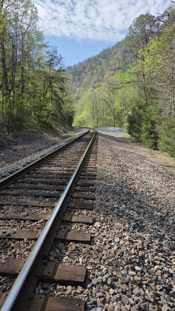
The most adventurous part of my day was coming down off the mountain and having to cross the Nantahuckey river. There used to be a bridge and the trail went straight across that bridge. But the bridge was washed out in Hurricane Helene and so there was a 3.8 mile detour through a town. You had to walk up one river bank a long way to a bridge and then down the other. I took a look at a rapids a little bit downstream from where the bridge was washed out and realized I could probably cross it. So I removed my socks and my insoles from my shoes, rolled up my pant legs, put all of my electronic gear and those socks and insoles into one of my food bags, which are waterproof, and proceeded to walk across, using the three points of contact rule, namely that either one pull and two feet, or two poles and one foot, are in contact with the bottom of the river at all times. There were a couple of places where the current was quite strong, but it never rose more than about five inches above my knees. I got across and then let my feet air dry, wrung out my shoes, put my socks and insoles back on, and rolled my pant legs back down. The shoes really didn’t feel that uncomfortable. I then proceeded to walk back up the opposite riverbank towards where the trail resumes.
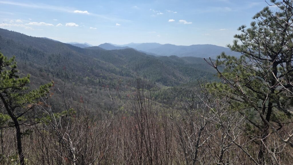
I spent much of the day looking down on views of Erwin Tennessee where many people go to resupply or have a zero day. I had thought of going there since there was a grocery store only a couple of kilometers out of my way, but I still have 3 days worth of food and it seemed silly to go get more food when I’m constantly carrying too much food.
I saw very few through hikers on the trail. The first one I saw was Chairman, so-called because he has a chair strapped to the back of his pack. He claims it’s the best thing he brought on trail. I can understand. Right niw I’m sitting on a cold, hard, bumpy rock that is too short.
At one point I missed a turn, and stepped over a bunch of logs without noticing, and proceeded up a trail that got less and less defined as I went. Eventually I realized this was not the AT. I checked my map and found a lookout but no trail marked to it. I was close enough that it wasn’t worth turning around. So I climbed up on High Rock and got a great view of both the town of Erwin and mountains on the other side. When I got back to the main trail I soon ran into Chairman who admitted that he made the same mistake I had, but had turned back sooner. He told me that there was no water for another five miles, and he was worried about running out. I checked my water supplies and realized I only had one and a half liters, which on a hot day like today didn’t seem like enough to last five miles, but I somehow made do.
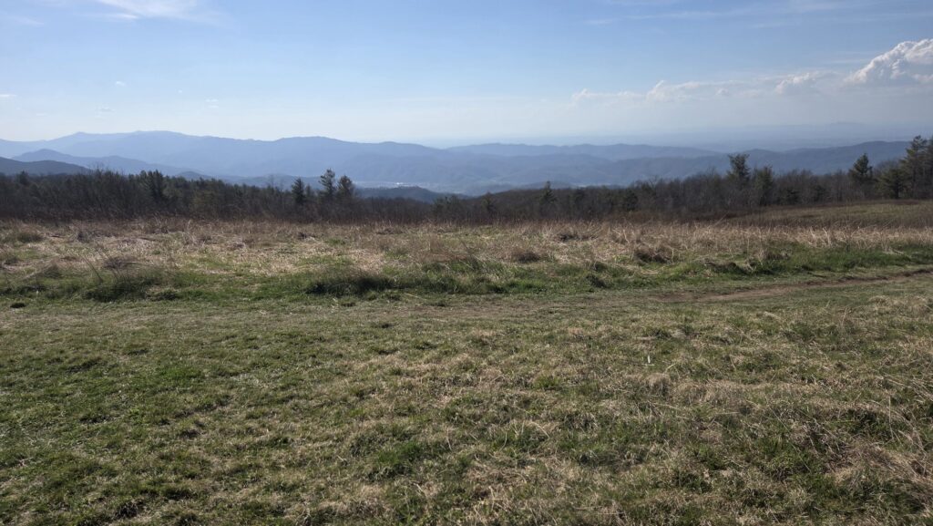
The trail climbed to Beauty Spot, a grassy bald with views on all sides. Another hour from there I reached the next water source, a gushing piped spring. I met a man my age whose trailname I’ve forgotten. He and several others were camped downhill from the spring, but the sites were very slanted and I didn’t want to try that again. After chatting and filling five liters of water I headed on uphill to an unofficial campsite purportedly containing some flat tent sites according to the FarOut app. Sadly no one else is camped here. I found a sloped site that is at least not as sloped as the ones by the spring. In spite of arriving at 6:30 I had dinner made, food hung, tent up, and all my bedding ready by 7:30.
Just now I was convinced I heard a bear growling. After shouting a few times I realized it was a car motor without a muffler, revving in the distance. There’s a dog barking nearby, probably half a mile away. Should get a nice sunset through the fir trees.
Mile 338.3 to mile 357.9 = 19.6 miles. Let’s say 20 counting my accidental detour!